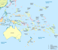
File:Indonesia, administrative divisions - de - colored.svg

此SVG文件的PNG预览的大小:800 × 367像素。 其他分辨率:320 × 147像素 | 640 × 294像素 | 1,024 × 470像素 | 1,280 × 588像素 | 2,560 × 1,176像素 | 982 × 451像素。
原始文件 (SVG文件,尺寸为982 × 451像素,文件大小:1.48 MB)
文件历史
点击某个日期/时间查看对应时刻的文件。
| 日期/时间 | 缩略图 | 大小 | 用户 | 备注 | |
|---|---|---|---|---|---|
| 当前 | 2023年12月2日 (六) 12:56 |  | 982 × 451(1.48 MB) | NordNordWest | upd |
| 2023年11月30日 (四) 21:09 |  | 982 × 451(874 KB) | Mrmw | cleaned code | |
| 2022年7月18日 (一) 14:12 |  | 982 × 451(809 KB) | Afrogindahood | Minor font outlines fix | |
| 2022年7月18日 (一) 14:10 |  | 982 × 450(758 KB) | Afrogindahood | Addition of new provinces in Western New Guinea | |
| 2021年8月13日 (五) 16:07 |  | 982 × 450(1.22 MB) | Afrogindahood | Resolution update to conform with the new imagemap poly coordinates | |
| 2013年7月10日 (三) 20:23 | 1,200 × 460(1.48 MB) | NordNordWest | Atauro -> East Timor | ||
| 2013年6月30日 (日) 12:43 | 1,200 × 460(1.47 MB) | NordNordWest | upd | ||
| 2012年8月8日 (三) 13:24 | 1,200 × 460(1.35 MB) | TUBS | == {{int:filedesc}} == {{Information |Description={{de|Karte der politischen Gliederung von XY (siehe Dateiname)}} {{en|Map of administrative divisions of XY (see filename)}} |Source={{own}}{{Adobe Illustrator}}{{Commonist}}{{AttribSVG|East_Kalimantan... |
文件用途
以下页面使用本文件:
全域文件用途
以下其他wiki使用此文件:
- azb.wikipedia.org上的用途
- de.wikipedia.org上的用途
- Liste der Städte in Indonesien
- Verwaltungsgliederung Indonesiens
- ISO 3166-2:ID
- Liste subnationaler Verwaltungseinheiten
- Diskussion:Liste subnationaler Verwaltungseinheiten
- Vorlage:Imagemap Indonesien1
- Liste der Verwaltungseinheiten Indonesiens
- Diskussion:Liste der Verwaltungseinheiten Indonesiens
- Provinzen Indonesiens
- Wikipedia:Grafikwerkstatt/Archiv/2023/November
- de.wikivoyage.org上的用途
- frr.wikipedia.org上的用途
- hu.wiktionary.org上的用途
- lb.wikipedia.org上的用途
- mdf.wikipedia.org上的用途
- sco.wikipedia.org上的用途
- sh.wikipedia.org上的用途
- sr.wikipedia.org上的用途


