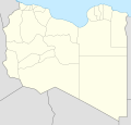
File:Libya relief location map.jpg

本预览的尺寸:625 × 599像素。 其他分辨率:250 × 240像素 | 500 × 480像素 | 801 × 768像素 | 1,068 × 1,024像素 | 1,617 × 1,551像素。
原始文件 (1,617 × 1,551像素,文件大小:1.13 MB,MIME类型:image/jpeg)
文件历史
点击某个日期/时间查看对应时刻的文件。
| 日期/时间 | 缩略图 | 大小 | 用户 | 备注 | |
|---|---|---|---|---|---|
| 当前 | 2011年5月9日 (一) 17:28 |  | 1,617 × 1,551(1.13 MB) | Carport | right file... |
| 2011年5月9日 (一) 17:25 |  | 1,617 × 1,551(1.13 MB) | Carport | update | |
| 2010年3月11日 (四) 16:33 |  | 1,617 × 1,551(1.22 MB) | Carport | {{Information |Description={{de|Physische Positionskarte von {{w|Libyen|3=de}}}} Quadratische Plattkarte, N-S-Streckung 110 %. Geographische Begrenzung der Karte: * N: 33.4° N * S: 19.1° N * W: 9.1° O * O: 25.5° O {{en|Physical location map of {{w|Lib |
文件用途
以下6个页面使用本文件:
全域文件用途
以下其他wiki使用此文件:
- ar.wikipedia.org上的用途
- arz.wikipedia.org上的用途
- ast.wikipedia.org上的用途
- az.wikipedia.org上的用途
- ba.wikipedia.org上的用途
- be.wikipedia.org上的用途
- bg.wikipedia.org上的用途
查看此文件的更多全域用途。

