File:Map helgoland 1910.jpg

本预览的尺寸:470 × 599像素。 其他分辨率:188 × 240像素 | 603 × 769像素。
原始文件 (603 × 769像素,文件大小:344 KB,MIME类型:image/jpeg)
摘要
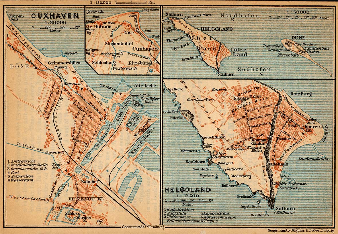
| 描述 | Map of Heligoland, Germany, 1910 |
| 日期 | |
| 来源 | http://www.lib.utexas.edu/maps/historical/baedeker_n_germany_1910/cuxhaven_helgoland_1910.jpg |
| 作者 | "Northern Germany as far as the Bavarian and Austrian Frontiers; Handbook for Travellers" by Karl Baedeker. Fifteenth Revised Edition. Leipzig, Karl Baedeker; New York, Charles Scribner's Sons 1910. |
| 授权 (二次使用本文件) |
"Courtesy of the University of Texas Libraries, The University of Texas at Austin." http://www.lib.utexas.edu/maps/map_sites/hist_sites.html |
| 其他版本 |
此文件衍生的作品: Map helgoland 1910 cropped.jpg cut from Image:Map cuxhaven helgoland 1910.jpg |
许可协议
|
本作品在其来源国以及其他著作权期限是作者逝世后70年或以下的国家和地区属于公有领域。 | |
| 本文件已被确认为免除已知的著作权法限制(包括所有相关权利)。 | |
文件历史
点击某个日期/时间查看对应时刻的文件。
| 日期/时间 | 缩略图 | 大小 | 用户 | 备注 | |
|---|---|---|---|---|---|
| 当前 | 2006年4月23日 (日) 17:28 | | 603 × 769(344 KB) | 700 MB | {{Information| |Description=Map of Heligoland, Germany, 1910 |Source=http://www.lib.utexas.edu/maps/historical/baedeker_n_germany_1910/cuxhaven_helgoland_1910.jpg |Date=1910 |Author="Northern Germany as far as the Bavarian and Austrian Frontiers; Handbo |
文件用途
以下页面使用本文件:
全域文件用途
以下其他wiki使用此文件:
- cs.wikipedia.org上的用途
- en.wikipedia.org上的用途
- en.wikiversity.org上的用途
- eu.wikipedia.org上的用途
- fy.wikipedia.org上的用途
- gl.wikipedia.org上的用途
- ja.wikipedia.org上的用途
- mk.wikipedia.org上的用途
- nl.wikipedia.org上的用途
- nn.wikipedia.org上的用途
- pl.wikipedia.org上的用途
- uk.wikipedia.org上的用途
- vi.wikipedia.org上的用途
- yi.wikipedia.org上的用途