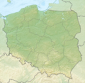
File:Poland location map.svg

此 SVG 檔案的 PNG 預覽的大小:617 × 600 像素。 其他解析度:247 × 240 像素 | 494 × 480 像素 | 790 × 768 像素 | 1,053 × 1,024 像素 | 2,107 × 2,048 像素 | 861 × 837 像素。
原始檔案 (SVG 檔案,表面大小:861 × 837 像素,檔案大小:213 KB)
檔案歷史
點選日期/時間以檢視該時間的檔案版本。
| 日期/時間 | 縮圖 | 尺寸 | 使用者 | 備註 | |
|---|---|---|---|---|---|
| 目前 | 2012年10月2日 (二) 12:34 |  | 861 × 837(213 KB) | Palosirkka | Reverted to version as of 20:23, 23 November 2011 Location maps must remain very accurate |
| 2012年10月1日 (一) 20:37 |  | 861 × 837(196 KB) | Palosirkka | Scrubbed with http://codedread.com/scour/ | |
| 2011年11月23日 (三) 20:23 |  | 861 × 837(213 KB) | NordNordWest | upd | |
| 2008年12月8日 (一) 11:28 |  | 862 × 838(377 KB) | NordNordWest | Reverted to version as of 09:25, 8 July 2008, an often used image shouldn't be changed without discussion | |
| 2008年12月8日 (一) 09:26 |  | 862 × 838(378 KB) | Mareklug | I made the featured background (territory of Poland) pure white for better contrast. | |
| 2008年7月8日 (二) 09:25 |  | 862 × 838(377 KB) | NordNordWest | {{Information |Description= {{de|Positionskarte von Polen}} Quadratische Plattkarte, N-S-Streckung 160 %. Geographische Begrenzung der Karte: * N: 55.2° N * S: 48.7° N * W: 13.8° O * O: 24.5° O {{en|Location map of Poland} |
檔案用途
下列頁面有用到此檔案:
全域檔案使用狀況
以下其他 wiki 使用了這個檔案:
- ar.wikipedia.org 的使用狀況
- arz.wikipedia.org 的使用狀況
- av.wikipedia.org 的使用狀況
- bn.wikipedia.org 的使用狀況
- bs.wikipedia.org 的使用狀況
- ceb.wikipedia.org 的使用狀況
- ckb.wikipedia.org 的使用狀況
- de.wikipedia.org 的使用狀況
- diq.wikipedia.org 的使用狀況
- en.wikipedia.org 的使用狀況
- en.wikivoyage.org 的使用狀況
- en.wiktionary.org 的使用狀況
- eo.wikipedia.org 的使用狀況
- eo.wikivoyage.org 的使用狀況
- es.wikipedia.org 的使用狀況
- fa.wikipedia.org 的使用狀況
- fo.wikipedia.org 的使用狀況
- fr.wikipedia.org 的使用狀況
- hr.wikipedia.org 的使用狀況
- hsb.wikipedia.org 的使用狀況
- hu.wikipedia.org 的使用狀況
檢視此檔案的更多全域使用狀況。


