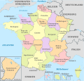
File:Togo, administrative divisions - de - colored.svg

此SVG文件的PNG预览的大小:408 × 599像素。 其他分辨率:163 × 240像素 | 327 × 480像素 | 523 × 768像素 | 697 × 1,024像素 | 1,395 × 2,048像素 | 425 × 624像素。
原始文件 (SVG文件,尺寸为425 × 624像素,文件大小:138 KB)
文件历史
点击某个日期/时间查看对应时刻的文件。
| 日期/时间 | 缩略图 | 大小 | 用户 | 备注 | |
|---|---|---|---|---|---|
| 当前 | 2023年12月28日 (四) 12:16 |  | 425 × 624(138 KB) | TUBS | Reverted to version as of 15:55, 2 November 2012 (UTC) Look, there's a reason why this is named "de'. De stands for German. If you want to have a multilingual version w/o text paths but TT instead, please upload your own file |
| 2023年12月23日 (六) 19:59 |  | 512 × 752(108 KB) | Glrx | try Noto Sans / condensed | |
| 2023年12月23日 (六) 01:02 |  | 512 × 752(108 KB) | Glrx | +es | |
| 2023年12月22日 (五) 22:03 |  | 512 × 752(107 KB) | Glrx | +zh | |
| 2023年12月22日 (五) 21:54 |  | 512 × 752(107 KB) | Glrx | +smn | |
| 2023年12月22日 (五) 21:50 |  | 512 × 752(107 KB) | Glrx | remove path text; use styles; breakout font characteristics; +en | |
| 2012年11月2日 (五) 15:55 |  | 425 × 624(138 KB) | TUBS | == {{int:filedesc}} == {{Information |Description={{de|Karte der politischen Gliederung von XY (siehe Dateiname)}} {{en|Map of administrative divisions of XY (see filename)}} |Source={{own}}{{Adobe Illustrator}}{{Commonist}}{{AttribSVG|Togo_-_Centrale... |
文件用途
以下页面使用本文件:
全域文件用途
以下其他wiki使用此文件:
- de.wikipedia.org上的用途
- de.wikivoyage.org上的用途
- es.wikipedia.org上的用途
- frr.wikipedia.org上的用途
- it.wikipedia.org上的用途
- mt.wikipedia.org上的用途
- sco.wikipedia.org上的用途


